Flood Studies: A Brief Introduction

We’ve had a lot of flooding in central North Carolina over the last year. Hurricanes, tropical storms, and even summer thunderstorms have caused local lakes and rivers, such as Lake Jorden and Crabtree Creek, to rise and flood nearby roadways, bridges, and structures. In July of 2025, UNC published a study showing that flooding is more common and widespread in the state than we had previously thought. In the face of this study and the apparent increase of damage, flood preparedness tools can reduce the risk of the loss of property and life. One of the tools that A&O employs is the flood study.

What is a Flood Study

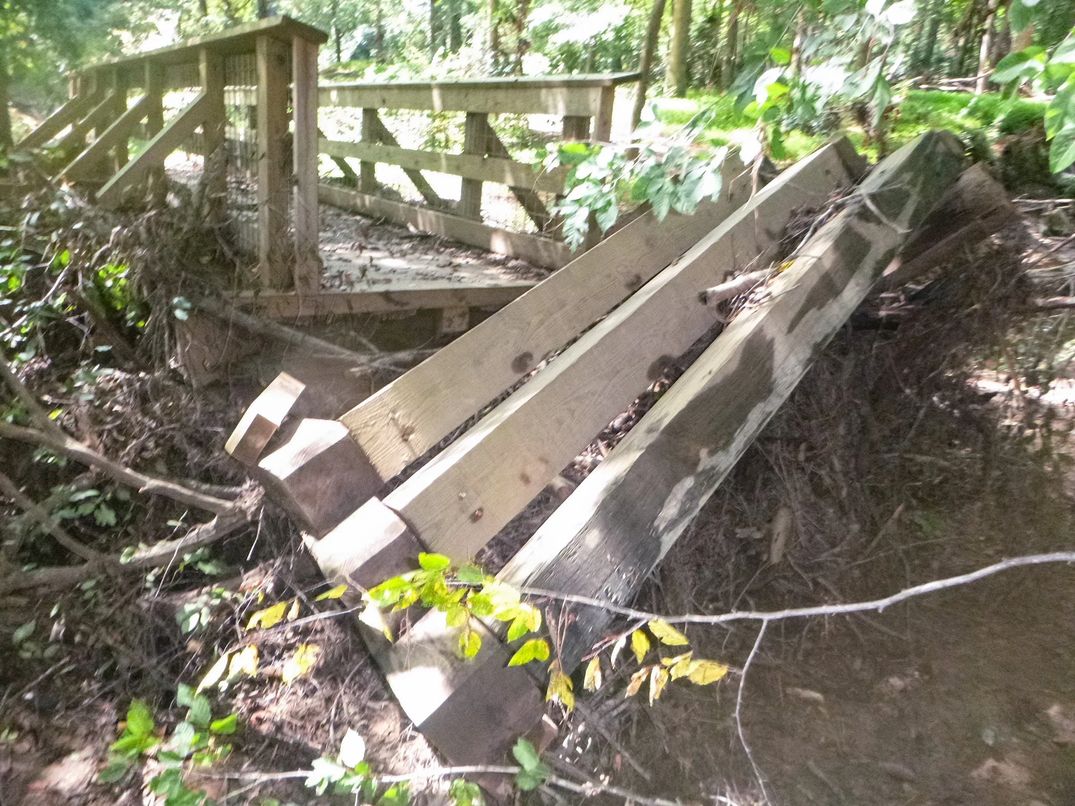
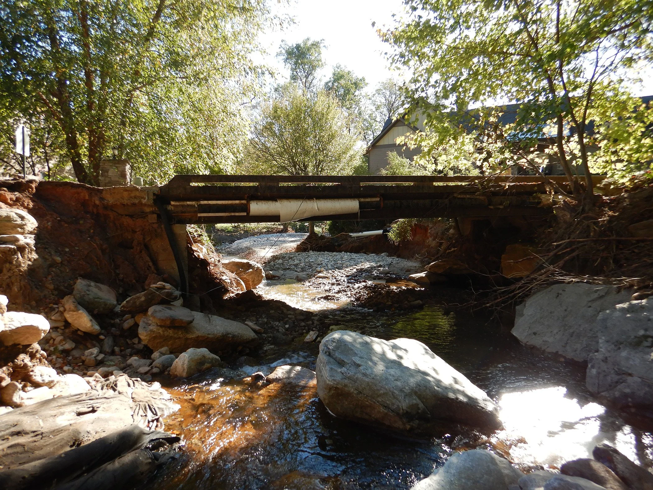
A ruined bridge in a state park

A flood study is an analysis of a stream, river, or lake to learn what the impact of a flood would be. FEMA and other official studies use the 100-year flood, a flood that has a 1% chance of occurring each year, as a standard. This is mostly for insurance or regulatory purposes, and it’s possible to use a 25-year, 500-year or even a 1,000-year flood in a study as well. Using a flood study, it’s possible to learn how deep a projected flood will be, how far it will go past the banks or shore, and even the velocity of the flood waters.

What are they used for?

A damaged section of Hillsborough’s RiverWalk Trail

The primary goal of flood studies is risk prevention. In this vein, the first step in preventing loss of property or life in a flood is to make sure that the buildings are not constructed within a flood hazard zone. While flood studies are often used for insurance, developers and property owners can also have a flood study done so that structures can be built outside of affected areas.

Are they only for buildings?

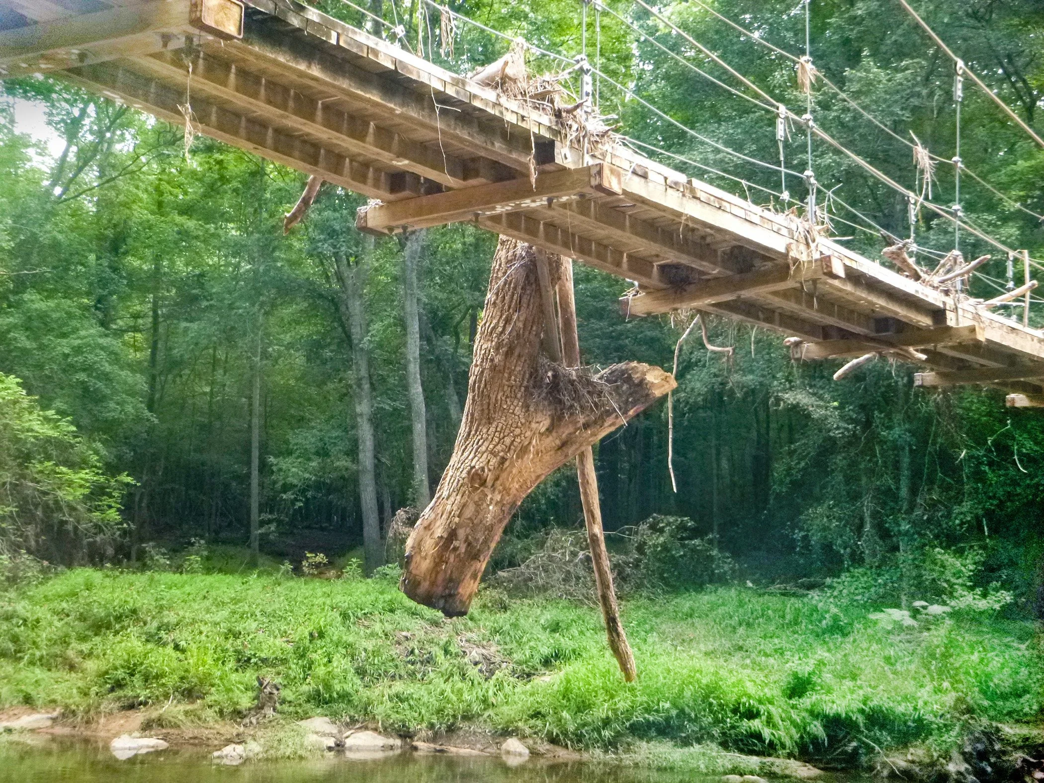
The eno river suspension bridge with a tree branch brought from floodwaters still attached

Flood studies are just as important for greenways, roadways and bridges. When constructing a roadway or pedestrian bridge over water, a flood study can estimate the likely location and height of floods. This helps us to design and place bridges to span those areas. Roadways and greenways can use them so that people and cars can travel more safely and minimize the risk of flood damage. Dams that affect people or property also require flood studies as part of the EAPs discussed in our other posts. Flood studies are a necessary part of the safety of multiple types of structures.

As we become more aware of the risk of flooding in North Carolina, the need for risk assessment increases. By constructing buildings outside of potential hazard zones, building bridges that span floodplains, and designing roads to avoid dangerously low areas, losses of life and property can be potentially avoided. Even in the case of sudden emergencies or flooding that exceeds the proposed scope, existing prevention measures, such as EAPs, can help to forewarn people most at risk. While we hope that the future brings a decrease in severe storms and the disasters associated with them, A&O hopes to be at the forefront of helping communities understand potential flood risks and developing practical solutions to support them and prepare them for the future.

If you are interested in learning more about our work in bridge design, flood studies, EAPs and inspection services, please visit our project pages.

Stormwater Control Measures: A Brief Introduction

One hazard of urbanization is stormwater runoff. Water running off from lawns, houses, and commercial buildings causes erosion damage and can be toxic for plants and wildlife when it reaches streams or ponds. It can also be toxic for humans when it enters our drinking water. To avoid the worst effects, stormwater control measures (SCMs) exist to trap runoff, release it slowly, and remove pollutants. However, not all SCMs perform the same way. Different SCMs are chosen based local regulations, topography, and the land available. Here are a few SCMs that we at A&O design and use in many of our development projects.

Dry Detention Ponds

Stormwater Management in action

Dry detention ponds work very well to remove pollutants and control water flow. In a dry detention pond, stormwater flows into a basin that fills and then slowly releases that water over a few days to allow solids and pollutants to settle rather than entering nearby streams. While this process only filters minimal pollutants, it works to avoid sudden flooding and erosion damage. The trapped water releases slowly, and that works to maintain a steady water level.

Bioretention Ponds

Bioretention ponds are a way to improve stormwater quality, aid in erosion control, and provide landscaping. Bioretention ponds capture the “first flush” of stormwater, which usually contains the highest concentration of pollutants. The trapped water flows through specially engineered soils to filter out toxins and microbes. It filters through a layer of mulch and specially chosen plants or grass and then the rest of the engineered soil. Roots, bacteria, and insects then remove excess nitrogen and phosphorus, much like a natural ecosystem. Usually, an underdrain piping system built under the pond collects the infiltrated water where it flows into nearby waterways.

A Bio Retention Pond

Permeable Pavement

Permeable pavement is designed to mitigate flooding and provide detention for the runoff of impervious pavement and concrete. The pavement can be made of porous concrete, porous asphalt, pavers, and rigid plastic grid panels filled with stone to allow water passage. This system allows stormwater to gradually filter through underlying soil or be collected in an underdrain and released through a slow discharge and filtering. Due to sand and silt clogging pores, permeable pavement tends to require regular maintenance.

Level Spreaders

Level spreaders are another method to reduce erosion impacts. This is usually the last element of a series of SCMs to discharge stormwater without erosion damage. Level spreaders are a level, shallow ditch with a lip made from some non-erodible material on its down-stream side. During rain, stormwater fills the ditch, but this lip acts like a buffer so that the water must build up and spill evenly into a gravel verge. It then flows through a vegetative filter into an undisturbed wooded area. This method controls flooding and erosion and helps to purify the water. When it eventually flows into nearby waterways, it does so at a controlled speed and with far less pollutants.

A Level Spreader

Stormwater control is a required part of any site design from urban roadways to mountain shooting ranges. Every method has strengths and weaknesses that may make it better suited for a particular task or environment. We know that the stormwater infrastructure and SCM designs we provide offer critical stormwater mitigation that reduces the flooding and pollution on every site we work on. Alpha & Omega Group is proud that our work provides safety and helps us act as good stewards of the precious resource of water.

If you want to learn more about some of our stormwater work, please visit our project pages, including the Raleigh Chinese Christian Church, our award-winning Mountains to the Sea design for Lincoln Heights, and our ongoing work for the Nantahala Shooting Ranges.